When drones began emerging into mainstream commercial use, it seemed like the sky was the limit for how this technology would impact farm management and farmland appraisal. But now that outlooks have become a bit more grounded, how are these professions actually making use of drones today?
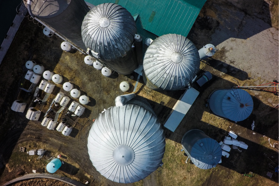
For appraisers, the obvious advantage of using a drone is gaining an aerial perspective that allows you to view a property from different angles and inspect areas that would normally be difficult to access.
"The primary purpose was getting a better view of the things we’re trying to evaluate,” said Dave Cullins, Senior Vice President of Administration for
, who oversees a team of appraisers. “Basically, it’s an extension of our cameras.”
“When you’re riding with a farmer and you’re there to see 500 head of cattle and it’s 2,000 acres in rough country, sometimes you can’t drive where you want to go,” he added. “A drone can give you a real-time look at what you're there to see.”
Cullins has also found a way to employ drone technology for chattel inspections in the livestock industry, specifically when it comes to
For appraisal and farm management businesses that are also involved in real estate brokerage, the value of aerial photography and video can be hard to overstate. Howard Halderman, AFM, owner of
Halderman Real Estate and Farm Management, favors the use of drones for this side of his company.
“I’d say 80% of our use probably comes from our real estate marketing side,” explained Halderman. "That is for still photography as well as video and creating lots of virtual tours of properties.”
Good quality drone video and imagery can help your marketing stand out from competitors. “Drones help us highlight the best of a property, and also highlight the things we need to improve,” said Tim Cobb, AFM, who owns
Farmland Company in Spokane, Washington.
When a nearby university was deciding on a broker to sell a 7,000-acre ranch, Cobb created a marketing video made with drone footage highlighting the property’s best characteristics. A member of the university’s decision-making committee approached Cobb afterwards, thanking him for his preparation and utilizing video.
“We did everything we could to separate ourselves out from the rest,” he said. “I don’t know what happened in the rest of those interviews, but I do know that I received the assignment.”
Cobb also uses drones in his farm management work, though to a lesser extent. For an irrigated corn crop, a drone can help identify plugged sprinklers or similar issues, allowing his team to activate quickly to save bushels.
In the Arkansas delta, Jeffrey Hignight, AFM, finds drones useful for identifying water-related issues as well. “Sometimes the beavers like to make dams,” he said. “The drone is a good way to locate it so that you can remove the dam and get your farm draining again.”
Hignight, who works for
Glaub Farm Management, believes drones are also a useful tool for surveying land.
“In our part of the world, we’re irrigating with what we call polypipe – basically a plastic tube that is laid along the high point of the field with holes punched in it so water can go down the furrow,” he explained. “A drone can take the elevation so that information can be put into a program that can tell you what sized hole needs to be punctured along the pipeline.”
Hignight uses drones to survey land when doing dirt work as well, including land leveling and precision grading.
The best and most interesting uses for drones might still lie ahead, when drone-integrated technologies like remote sensing become more practical and commonplace.
“Remote sensing can literally tell you the nitrogen content of the leaves at a very granular level,” said Cullins. “If I can remotely collect information on how much nitrogen to use per acre, now you’re talking about million-dollar decisions.”
AI-based measurement may also become more prevalent as a tool for rural appraisers. This technology would take imagery captured by a drone and determine the length, width, and height of large structures. “Some of these barns we measure are really huge,” Cullins described. “We’re already seeing this at county appraisal districts, where they’re able to measure residences.”
When considering the applicability of drones for your business, it’s important to take into account the various regulations that now govern their use. While once upon a time drones were unregulated, the Federal Aviation Administration now requires testing, education, and licensing with recurrent requirements.
A pioneer of drone usage in the Farm Credit system, Cullins is now educating other Farm Credit branches on how to go about using drones in proper compliance with regulations. “Without being aware of all the things that a company needs to consider, you might make the mistake of just going and getting one,” he warned.
Regardless of the manner in which rural professionals are using drones today, there is a consensus surrounding their potential to add value to a business.
“I really feel that it has had an impact in my business,” said Cobb. “I’m a better overall ag professional partially because of the knowledge I gain from something that I can’t see otherwise, and that comes from drone technology.”